Your reservation didn’t come through. Now what?
Old Rag Mountain is one of the most famous hikes in Shenandoah National Park. Well-known for its strenuous rock scramble and stunning views, there were days in 2021 when more than 1,200 people made the trek to the summit.
The astounding number of hikers on Old Rag led to numerous problems. At times, the parking lot would overflow to surrounding roads, causing traffic and frustration among park visitors and residents alike. Bottlenecks along the trail often resulted in delays of more than an hour. The extreme uptick in visitors also led to more litter and to hikers going off-trail, seeking a way around the crowds. Off-trail hiking can harm park ecology, and it can also be dangerous, making rescue efforts for lost or injured visitors much more difficult.
For these reasons, Shenandoah National Park implemented a permitting system for Old Rag Mountain earlier this month. Staff will make 800 permits available each day through November 30 for $1 each. Given the popularity of Old Rag in 2021, it is safe to assume tickets will be difficult to come by on weekends in the spring, summer and fall.
If you are unable to secure a permit for Old Rag for your day in the park, or if you’re just looking for a hike with some solitude, consider these five alternatives. They offer similar experiences, such as rock scrambles and scenic views, without sharing the trail with 799 of your closest friends.
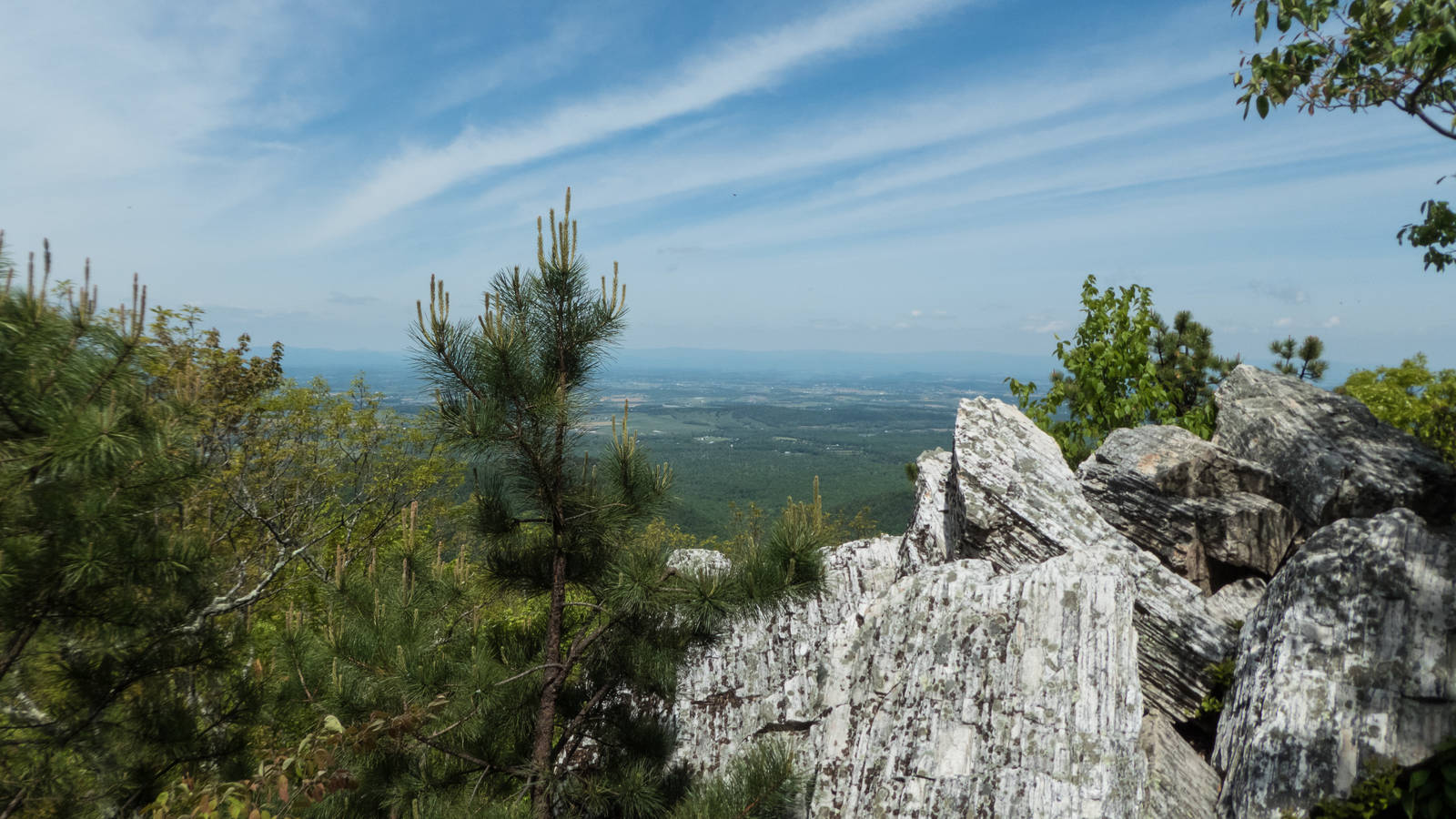
1. Bearfence Rock Scramble
If a challenging rock scramble is what drew you to Old Rag, but you’re looking to avoid the crowds, look no further than the Bearfence Rock Scramble. This loop trail is approximately 1.5 miles, with about three-quarters of a mile of scrambling along a craggy ridge. This short but challenging hike provides stunning 360-degree views of the surrounding area and can easily be completed in an hour or two, leaving plenty of time for other nearby hikes.
To access the hike, park at the Bearfence Parking Area at Mile 56.4 of Skyline Drive. Cross Skyline Drive and follow trail markers. Get more information and a trail map.
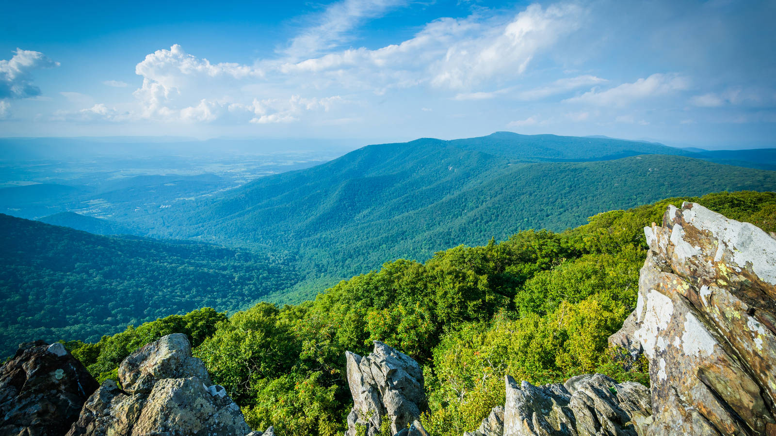
2. Hawksbill Summit
Hawksbill Summit is the highest peak in Shenandoah National Park, and at 4,049 feet in elevation, the viewing platform offers stunning 360-degree views of the surrounding area. You’ll even be able to see Old Rag Mountain directly to your east from the top of the mountain. The round-trip hike is about 2 miles out and back. The trail quickly gains nearly 700 feet in elevation, so it will certainly get your heart rate up. There is also a day-use shelter at the top of the mountain with a few picnic tables where you can enjoy lunch with one of the best views in the park.
There are two parking areas to reach Hawksbill Summit, the Hawksbill Gap Parking Area and the Upper Hawksbill Parking Area. From either parking area, follow the trail straight up to the peak. Get more information and a trail map.
3. Rapidan Camp/Mill Prong Trail
Set along the beautiful headwaters of the Rapidan River, Rapidan Camp was once the presidential getaway for President Herbert Hoover and his guests. President Hoover fished for trout in the nearby waters and entertained guests and dignitaries here, including Thomas Edison and Winston Churchill. This site was the precursor to the current presidential retreat, Camp David. After leaving office, Hoover donated the camp to the federal government, and it is now part of Shenandoah.
Getting to Rapidan Camp requires a scenic 2-mile downhill hike along the banks of Mill Prong. The trail features several stream crossings, so be prepared to rock hop or get your boots wet! Once you reach the camp, you’ll find several historic and restored cabins, including the Brown House where Hoover vacationed, which is open for tours for much of the spring, summer and fall. This is an excellent area for a streamside lunch. To return, simply retrace your footsteps back to Skyline Drive.
To reach Rapidan Camp, park at the Milam Gap Parking Area (mile 52.8 along Skyline Drive). Cross Skyline Drive and follow the trail down the mountain. Get more information and a trail map.
4. Browns Gap
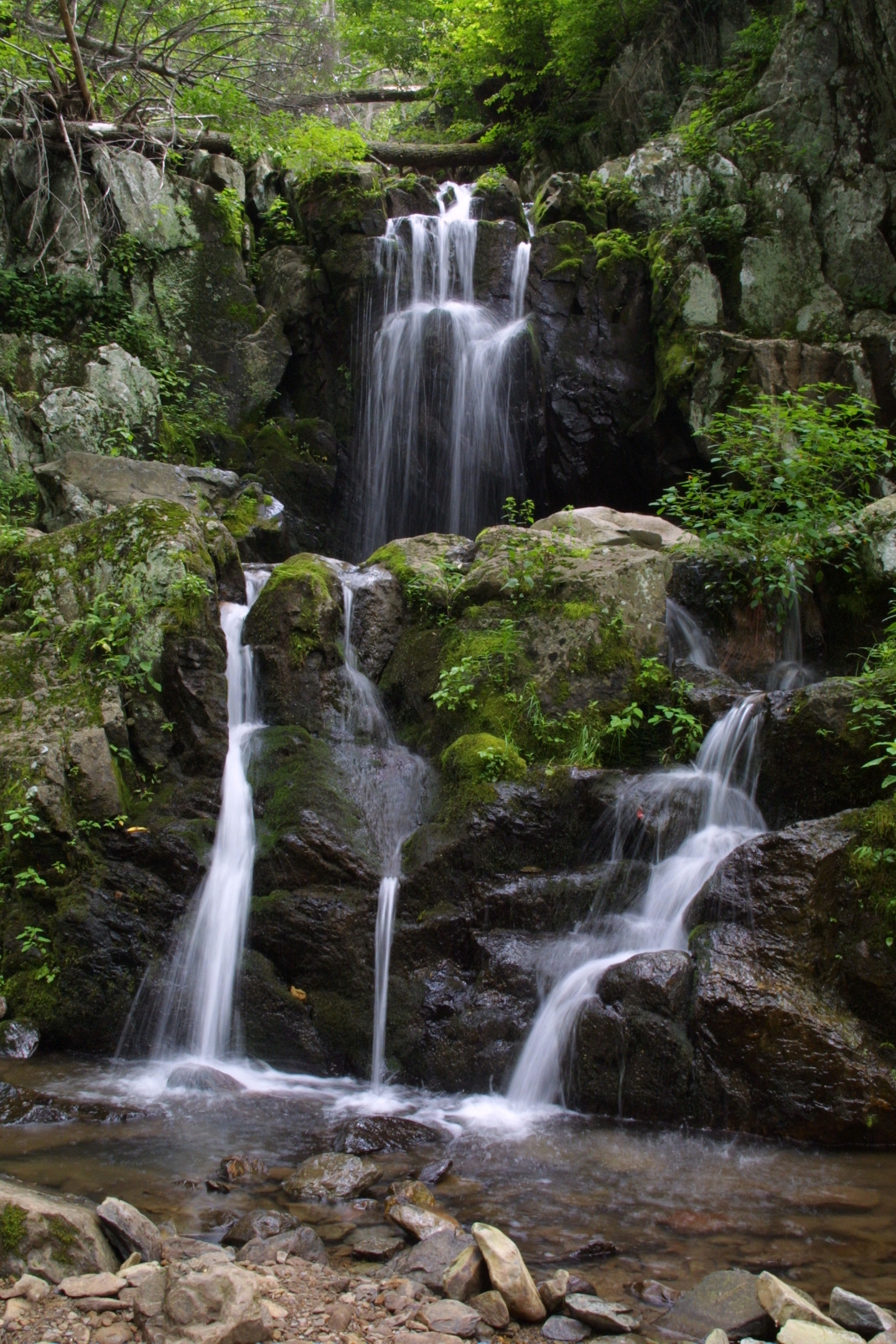
Doyles River Falls on the Browns Gap circuit hike
National Park ServiceIf a scenic and remote hike through a designated wilderness area with multiple spectacular waterfalls sounds like your cup of tea, then the Browns Gap hike will be right up your alley. This 6.5-mile loop trail is the perfect option for someone looking to escape into a much more remote section of Shenandoah National Park. The trail follows both the Doyles River and Jones Run and has three distinct waterfalls along the route. The hike has 1,400 feet of elevation gain, but since it is spread out along the entire loop, it rarely feels strenuous. Depending on your speed, the hike can take anywhere from four to six hours (or more, if you really take your time to enjoy the falls). I prefer to slow down and enjoy the wilderness with a waterfall picnic along the way.
To reach this hike, park at the Browns Gap Parking Area (Mile 83 of Skyline Drive) and follow the Browns Gap Fire Road down the mountain. Get more information and a trail map.
5. Wildcat Ridge/Riprap Trail
The Wildcat Ridge and Riprap Trail loop hike is the longest and most strenuous hike on this list. Coming in at just under 10 miles and nearly 2,400 feet in elevation gain, this hike is almost certain to take all day and strain you physically. But the solitude and stunning views along the way make it well worth the effort. This is the southernmost hike on this list and the easiest to access from the Waynesboro/Charlottesville area. Along this loop, you’ll pass scenic views at the Riprap Overlook, Calvary Rocks and Chimney Rock. This hike also includes several stream crossings and a remote waterfall.
To access this hike, park at either the Riprap Parking Area (Mile 90 along Skyline Drive) or the Wildcat Ridge Parking Area (Mile 92 along Skyline Drive). Since this is a loop hike, you can proceed clockwise or counterclockwise from either parking area and end up at your original location. Get more information and trail maps.
Stay On Top of News
Our email newsletter shares the latest on parks.
Shenandoah National Park has over 500 miles of trails. The above five are some of my personal favorites, but there are dozens of other amazing options to choose from. Get started on the park’s website.
While you’re there, don’t forget the basics. Stay on marked trails. Pack out any trash. Wear appropriate footwear and clothes and be prepared for potential shifts in the weather, such as sudden rainstorms. Lastly, be respectful of others on the trail, including wildlife. Happy hiking!
About the author
-
 Kyle Hart Mid Atlantic Senior Program Manager , Mid-Atlantic
Kyle Hart joined NPCA's Mid-Atlantic team in February 2020.
-
General
-
- Park:
- Shenandoah National Park
-
- NPCA Region:
- Mid-Atlantic
-
-
Issues
-
Blog Post
What to Expect When Visiting Parks in Summer 2026
Planning a park trip this season? Be prepared for traffic, crowds and unpredictability.
-
Blog Post
Thanking Park Staff this Earth Month
NPCA collected more than 750 messages of gratitude for park staff and shared them at park events across the country — and it’s not too late to leave your own…
-
Press Release
Interior Cancels Successful Reservation Systems at Arches and Yosemite, Makes Major Changes at Glacier
"Cancelling successful and commonsense solutions undermines National Park Service expertise and the safety of visitors, in favor of a free-for-all approach."–Cassidy Jones, NPCA's Senior Visitation Program Manager


