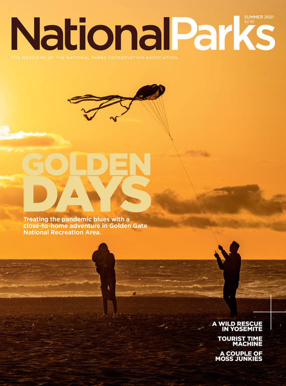
Summer 2021
Heading for the Hills
Treating the lockdown blues with a close-to-home adventure in Golden Gate National Recreation Area.
Bright morning sunlight glinted off the downtown skyline as we drove toward San Francisco on the Bay Bridge. From the elevated freeway, the Financial District looked like a glass-walled ghost town, block after block of darkened office buildings and vacant storefronts. I used to spend many of my waking weekday hours in a cubicle on the ninth floor of one of those towers and my lunch breaks weaving down crowded sidewalks, searching for an unclaimed patch of sun where I could eat my sandwich. Then the pandemic hit. My office, like so many others, closed indefinitely. I’d hardly set foot in the city for months.
It was early November. My sweetie, Marc, was in the passenger seat. We’d been by each other’s side almost constantly since spring, anxiously counting our blessings: to still have jobs and to be able to keep doing them from the safety of our home in Oakland. Still, without much else to distract me, I’d been paying probably too much attention to the headlines. Coronavirus case counts were back on the rise, and we didn’t know when a vaccine would be available. The outcome of the recent presidential election hadn’t yet been declared. A background malaise had been steadily accumulating until I had to admit it was not really in the background anymore.
In the past, I’d have solved this sort of problem by pulling up a map of the West and planning a road trip to a place I’d never been. But as the virus spread throughout the spring and summer, small-town residents, concerned about hospital capacity, pleaded with would-be visitors to stay away. Park facilities closed, then opened, then closed again. At any rate, we never really wanted to get too far from home in case one of us woke up with a fever.
So we decided to treat our lockdown blues with a trip to our backyard national park: Golden Gate National Recreation Area. The park includes more than three dozen sites in and around San Francisco, from the ancient redwoods in Muir Woods National Monument to the former federal prison on Alcatraz Island. At over 80,000 acres, Golden Gate is one of America’s largest urban national park sites, which partly explains why it’s so popular. Seven million people live within an hour’s drive, and 12.4 million visited the park in 2020.
In the seven years I’ve lived in the Bay Area, I’ve been lucky to work for, write about and even live in Golden Gate National Recreation Area. But I still haven’t seen anywhere near all of it. When Marc and I consulted the park map, we noted the places we’d never visited and decided to organize our trip around those. A few weeks later, with the trunk full of bikes and camping gear and my deserted office building receding in the rearview mirror, we headed for the forests and beaches along the Bay Area’s wild western edge.
Not 45 minutes after leaving home, we reached our first stop. The Mori Ridge Trail climbs up from Pacifica, a beachfront suburb south of San Francisco. Our visit coincided with the first big waves of the oncoming winter surf season, and as we started our hike uphill, we could hear them hammering the beach more than a mile away. After a few minutes of steep climbing, we emerged from the trees and paused to catch our breath and take in the view.
Montara Mountain, emerald green and nearly 2,000 feet high, rose straight up from the ocean to form the near southern horizon. The city of Pacifica filled in the valley floors between the mountains and the beach. To the north, we could see the neat outlying neighborhoods of western San Francisco and beyond that, the graceful spine of Mount Tamalpais. When we reached the crest of the ridge, the broad expanse of San Francisco Bay came into view, backed by the Oakland Hills and the massive shoulders of the East Bay’s tallest point, Mount Diablo. If we’d brought binoculars, we probably could have spotted the steeple of the church next to our house in Oakland, 20 miles away.
After heading straight uphill for a mile, the trail flattened out. We walked along Sweeney Ridge until we reached the spot, indicated by a dot on our map, where Spanish colonizers, led by Gaspar de Portolá, first laid eyes on San Francisco Bay back in 1769.
“The Spanish were welcome in Ohlone territory at that time,” said Jonathan Cordero, an assistant professor of sociology at California Lutheran University. An ethnohistorian who specializes in the California Mission Period and a Ramaytush Ohlone, he is descended from the people who have lived in this area for over 10,000 years. I called Cordero after our visit to learn more about this consequential encounter.
By all accounts, Cordero said, the soldiers and their mounts arrived in Ramaytush territory sick, malnourished and exhausted after months of difficult travel. “People from those villages would have cared for them, fed them and helped them get well. And then the villagers guided the soldiers to the top of the ridge,” where the Spanish saw the bay, he said.
At that point, Europeans had been sailing past the narrow Golden Gate strait for over two centuries, missing sight of the giant natural port of San Francisco Bay just beyond. Once the soldiers realized what they were looking at from atop the ridge, the race was on to establish a religious and military presence that would soon have devastating consequences for the area’s people and resources.
© KAREN MINOT
“There’s no getting past the fact that the Portolá expedition marked the beginning of the end for California Indians from Sonoma to San Diego who lived along the coast and inland,” Cordero said. “We are still suffering from colonialization today.”
Cordero consults with the Park Service, and in 2019, he helped develop an updated sign for the so-called “Portolá Discovery Site.” The new sign reads, in part: “The notion that America was vast and empty, waiting to be discovered and settled by Europeans, was based on the pretense that no one of significance was here before.”
Back down at the trailhead after the morning’s 1,000-foot climb, we were ready take it easy for a bit. I love a granola bar and a swig of warm water as much as the next hungry hiker, but one of the perks of visiting a national park in a metropolis is that you’re never far from a really good meal. We strolled down to Guerrero’s Taqueria in Pacifica to pick up two giant burritos and two cups of horchata and set out to find a suitable picnic spot on Mori Point, one of the most recent additions to Golden Gate National Recreation Area.
Just across Highway 1 from the taqueria, Mori Point is 110 acres of open space crossed by a few well-marked trails. The place has a long, odd history: Native people (and subsequently, the Spanish) quarried limestone here. Later, it was a ranch, an unofficial playground for off-road vehicles and briefly, a motorcycle club’s dirt track. Bootleggers sold liquor in a speakeasy here during Prohibition, and it’s where Harold sends his hearse off the cliff at the end of the film “Harold and Maude.” We walked to the tip of the point, which sticks out between two long, sandy beaches, and downed our burritos as waves exploded against the rocks, shooting whitewater high into the sky.
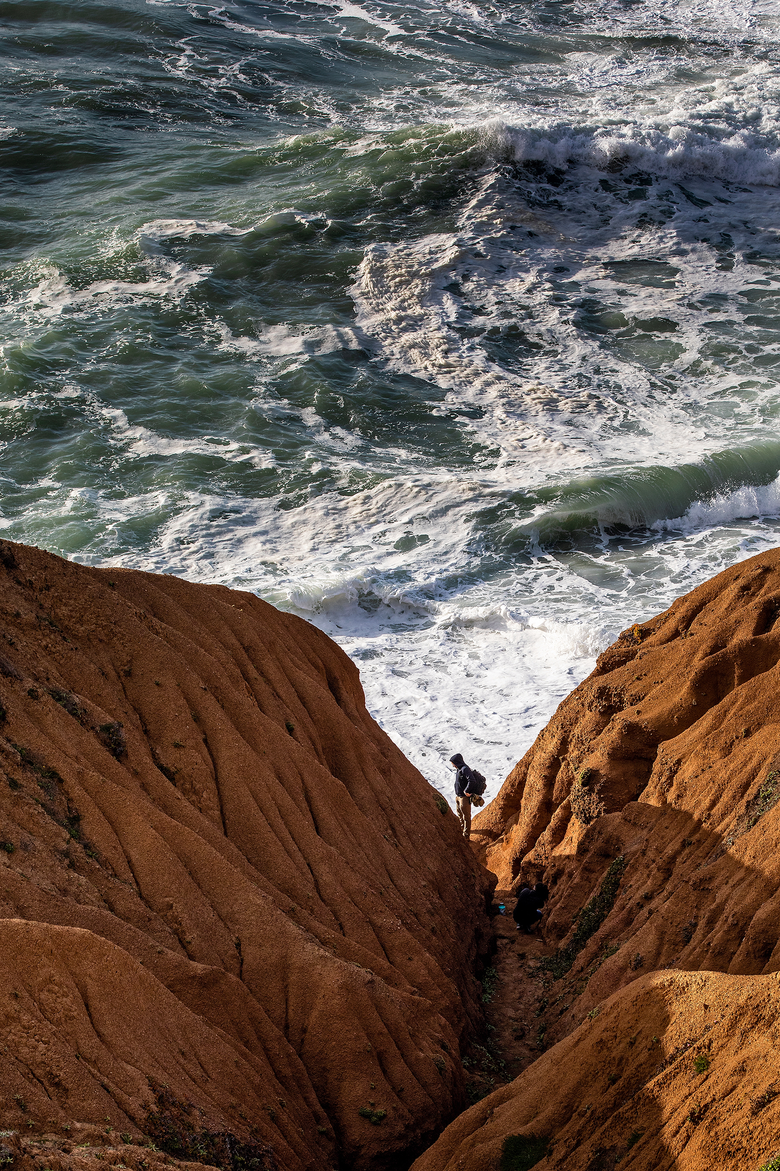
Mori Point in Pacifica, one of the most recent additions to Golden Gate National Recreation Area, wasn’t acquired by the Park Service until the early 2000s.
© PHILIP PACHECOAs the surrounding landscape got built up throughout the 20th century, Mori Point largely escaped development thanks in part to a force of Pacifica residents and conservation groups who blocked repeated proposals to build on the site, which remained in private ownership until the National Park Service acquired it in the early 2000s. But a very different sort of force shaped many of the other spots in the national recreation area: the United States military.
“For most of U.S. history, San Francisco Bay was the most important site on the West Coast: We had gold, shipping, dry docks and waterfront industries,” said historian John A. Martini. So from the Gold Rush through to the Cold War, “the military just poured money into defense infrastructure surrounding San Francisco.” While the Bay Area’s civilian population — and footprint — grew, the military held on to thousands of acres along the coast, building a chain of forts and gun batteries from which to keep a careful watch on the sea and sky.
Eventually, military technology evolved to the point that coastal defenses were no longer necessary, said Martini, a former ranger who spent most of his 25 years with the Park Service at the Golden Gate parks. “The threat wasn’t coming from warships, or even airplanes anymore: The development of intercontinental ballistic missiles in the 1960s rendered most of the Bay Area’s defense infrastructure obsolete.”
This change roughly coincided with the birth of the modern environmental movement in America — and in San Francisco, the drive to establish one of America’s first urban national park sites. President Richard Nixon signed the law creating Golden Gate National Recreation Area in 1972, and Fort Mason, Alcatraz and Fort Point were among the first of many erstwhile military sites that would eventually gain Park Service protection.
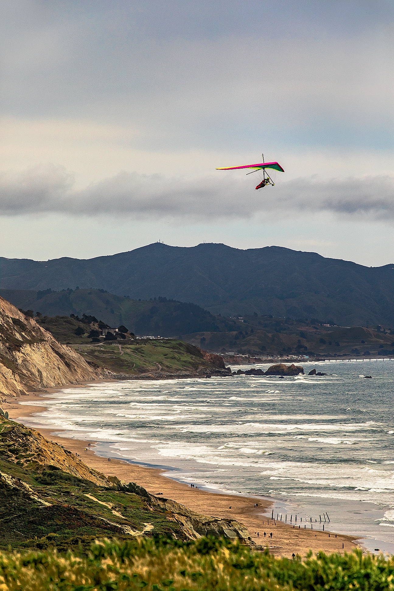
With its 200-foot cliffs, sandy dunes and consistent winds, Fort Funston is one of the world’s premier hang gliding spots.
© PHILIP PACHECOOnce we’d drained the last of our horchatas at Mori Point, we ambled back to our car and drove a few miles north up the coast to Fort Funston, seeking traces of the Bay Area’s military past. We were circling in the parking lot hunting for a spot when I caught a strange movement out of the corner of my eye. I looked up in time to see a hang glider zip by, seemingly inches off the ground, then gracefully turn and soar out over the long beach toward the open ocean. With its 200-foot cliffs, sandy dunes and consistent winds, Fort Funston is one of the world’s premier hang gliding spots. “What Australia’s Great Barrier Reef is for scuba divers, Fort Funston is for hang gliders,” said Steve Rodrigues, who’s been flying here since the 1980s.
Some of the qualities that make this stretch of coast a hang glider’s dream made it a strategically valuable spot for the military. For much of the 20th century, Fort Funston was home to numerous guns, aimed oceanward to repel attacks by sea. Today the guns are gone, but the structure that housed the largest ones remains. We spent a few minutes crawling around in a pair of concrete tunnels dug into a dune, imagining what it was like to be a soldier stationed here during World War II.
Martini counts more than 80 major fortification sites within Golden Gate, and park staff still periodically uncover smaller sites. “When the park was created, it was not with the thought that it had worthwhile historic resources,” he said. “The enabling legislation mentioned recreation and scenic values. It wasn’t until the Park Service got in and started looking around that they went, ‘Oh my God, look at all this stuff! We’ve got historic buildings out the kazoo!’”
Not all of the park’s historic buildings were born of military spending. My perennial favorite spot to impress visiting relatives in normal times is the Cliff House, a restaurant that teeters on the westernmost point of San Francisco. We’d splurge on cocktails and fresh-baked popovers at the upstairs bar, gawping through plate glass windows at Ocean Beach and the Pacific. But because of the pandemic, the Cliff House had been closed since March, aside from a few brief attempts at offering take-out only. (Soon after our visit, the restaurant’s owners announced they were going out of business for good, and the Park Service said they would seek new tenants.) So Marc and I picked up some cheap beers after leaving Fort Funston, then drove up the Great Highway to toast the sunset on the restaurant’s empty deck. The gathering wind deposited some beach grit into our drinks, and it was a little chillier than a seat at the bar, but we still got our happy hour with a view.
We spent the night in a room we’d rented in the basement of a grand old home a block uphill from the Cliff House. The previous day’s gusty winds built into a gale overnight. By the time we headed out for coffee the next morning, the ocean’s surface was a mess of mushy whitewater to the horizon.
Our plan was to ride bikes north along the coast from the Cliff House to the Golden Gate Bridge, stopping at a couple of park sites along the way — a route that would have us pedaling directly into the wind. Very reasonably, Marc proposed abandoning the bike idea. But my aversion to trying to find parking in San Francisco verges on pathological, so I buckled up my helmet and said something ill-fated like, “The wind will die down. You’ll see.”
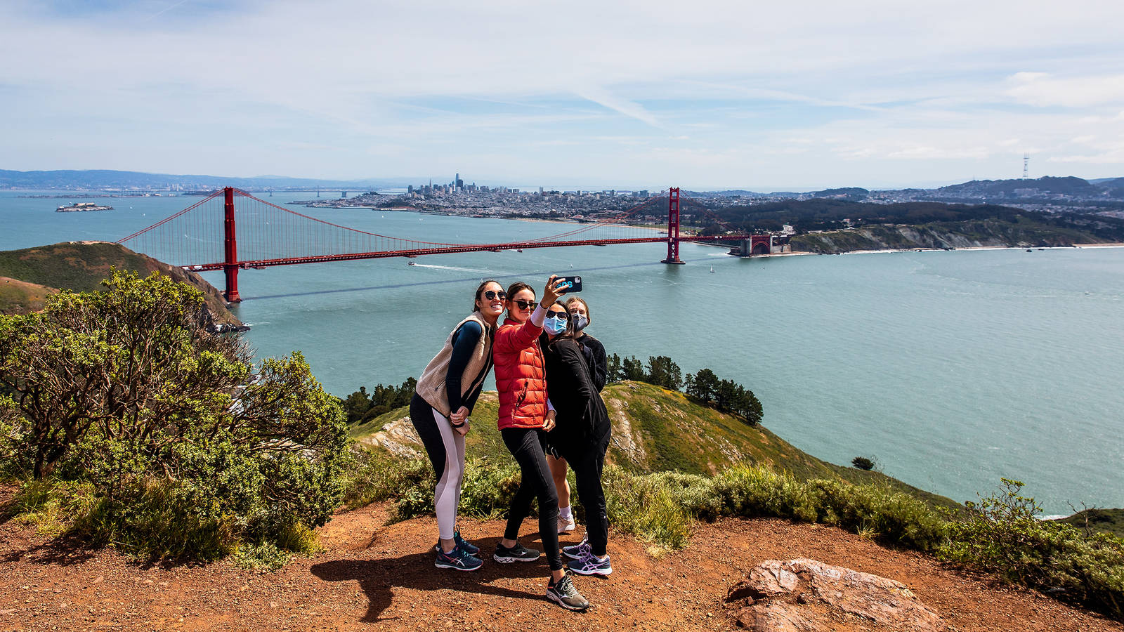
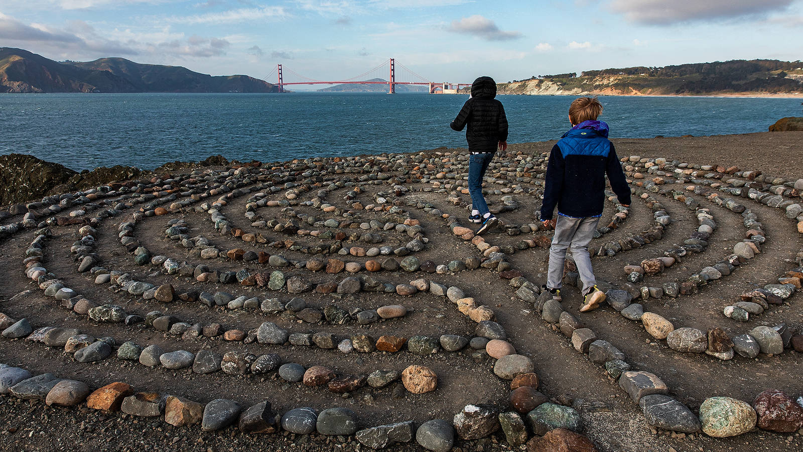
From the Cliff House, we picked up a trail through Lands End. This horseshoe-shaped section of the park caps the northwestern corner of the city, where shoulder-to-shoulder houses give way abruptly to forest and the continent crumbles into broken rocks at the water’s edge. We pedaled deeper into the forest until we lost all sight or sense of the city. All we could hear was the wind howling through the canopy above and the ocean bashing the cliffs below. After a mile or so, we locked our bikes to a tree and followed a short trail down through the forest and out to the end of a rocky spit, where we found a labyrinth that visitors had made by neatly arranging stones. (The labyrinth is not officially endorsed by the Park Service, but staff let it be.) I tried to get into the proper meditative headspace and pace my way through it, but the wind was strong enough to knock me off balance, and the labyrinth is close enough to the edge of the cliff to make losing footing sort of a serious proposition. So we retreated to the relative cover of the cypress forest and pedaled on. Soon we caught sight of our destination: the Golden Gate Bridge.
To get there, we pedaled (into the wind) through the ritzy Sea Cliff neighborhood, then (into the wind) along the coastal bluffs in the Presidio, a 2-square-mile former military base. Here, airy forests of sculpted cypress trees shelter enclaves of stately old houses and barracks. In 1989, Congress voted to end the Presidio’s military status and transfer the land to the Park Service. Today the Presidio’s 24 miles of trails are open to the public, and you can rent a home or business space in one of its historic buildings. When I moved to California, my first apartment was in the park, in a former nurses’ barracks.
At last we arrived at Fort Point National Historic Site, a three-story brick colossus crouched on the very northern tip of San Francisco. Dating to the mid-19th century, the structure is in what Martini calls “a remarkable state of preservation,” because it was untouched by the Civil War. “For soldiers stationed at Fort Point, it was a war against boredom,” Martini said.
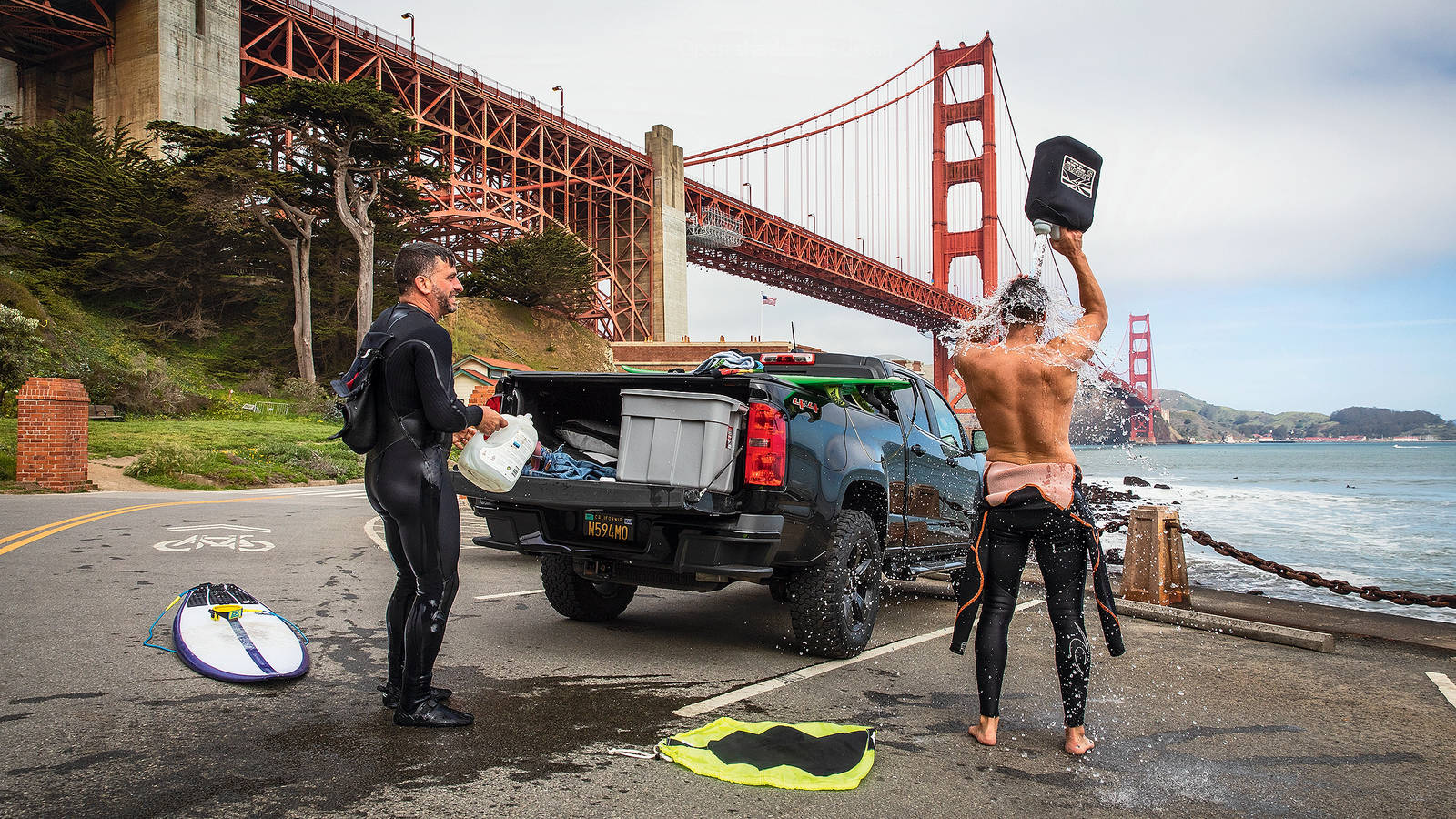
There are worse places to be bored, I thought as Marc and I climbed a spiral staircase to the fort’s roof for a better view of the mile-wide Golden Gate, which famously funnels a perpetual barrage of tides, wind and fog. A massive container ship lumbered under the bridge on its way out to sea. Peering over the brick parapets, we could look straight down on a gaggle of surfers bobbing in the bay, putting on a show of bravery in the face of the powerful waves that curled off the tip of the point.
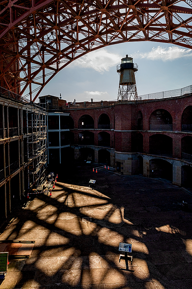
From atop Fort Point, visitors can look straight up into the nest of trusses that hold up the Golden Gate Bridge.
© PHILIP PACHECOBut the real show at Fort Point is overhead. From atop the fort, you can look straight up into the nest of trusses that hold up the Golden Gate Bridge. You’re close enough to count individual rivets, and you can see where the salt spray has eaten holes in the bridge’s iconic orange paint. Between the towering waves hitting the point, 40-mph winds whistling through the towers and the six lanes of traffic rumbling overhead, it is an awesomely, almost painfully, loud place. Still, I was starstruck by our up-close perspective of this most Californian of landmarks.
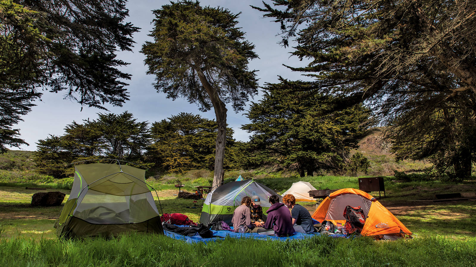
After giving up on trying to capture the grandeur of the strait with our iPhone cameras, we biked back to our car, relieved to have the wind at our backs. An hour later, we were getting the more conventional view of the bridge as we made the short drive over it to the Marin Headlands, where we’d snagged a coveted campsite. Marc and I both had to be on Zoom calls at 9 the next morning, but the recreation area’s Bicentennial Campground was only about 40 minutes from home, making it a fine candidate for our semi-regular tradition of “school-night sleep outs.”
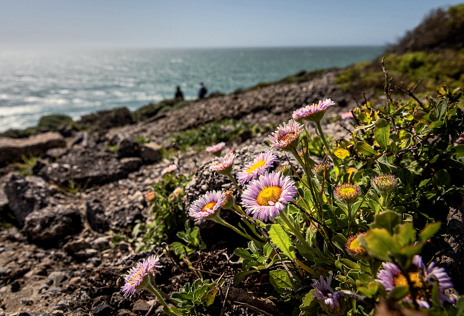
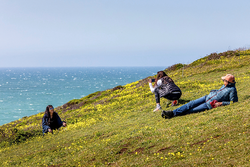
Though just a mile from San Francisco as the seagull flies, the Marin Headlands are surprisingly wild, an expanse of low coastal mountains, sea cliffs and sandy beaches. That’s no accident: In the early 1970s, after years of activism, a band of conservationists managed to wrest 2,000 acres in the heart of this area from the jaws of impending development and help turn the land over to the Park Service to manage.
ABOUT THE PHOTOGRAPHER
The road to our campground could have become a busy thoroughfare through a 30,000-person suburb, but instead it winds quietly along a willow-lined creek toward the coast. Our campsite was tucked in a hollow overlooking the ocean, so we had some protection from the weather. Still, while we wrestled the tent up and wrapped up in all our warm layers, I worried we were in for an uncomfortable night. My anxiety tipped into outright grumpiness when Marc pointed out a wall of black clouds building rapidly in the eastern sky. “If I didn’t know any better, I’d say it looks like rain,” he said.
“It won’t rain,” I said confidently. It had hardly rained a day since May, and my raincoat was tucked away in the back of my closet. Marc cocked an eyebrow, perhaps remembering the prediction I’d made that morning, just before we embarked on an unreasonably difficult (albeit beautiful!) upwind bike ride. Then, of course, it started to rain.

National Parks
You can read this and other stories about history, nature, culture, art, conservation, travel, science and more in National Parks magazine. Your tax-deductible membership donation of $25 or more entitles…
See more ›We dove into the tent and lay there, cozy while the storm closed in around us. Thankfully, it was just a short squall, blowing over as quickly as it came. As the raindrops tapered off, we poked our heads out and saw blue skies overhead. Better yet, behind the storm the air was completely calm. A minor miracle. “See?” I said triumphantly to Marc. “Told you the wind would die down!”
In the quiet after the storm, I felt my jaw unclench and my shoulders relax — a rare sensation during this crummiest of years. We strolled along the bluffs toward the end of the point. From this perspective, we could look back at pretty much everywhere we’d been over the course of our two-day voyage: the Golden Gate Bridge, the Presidio and Lands End, with the Cliff House, Ocean Beach, Fort Funston and Sweeney Ridge receding in the distance. A couple of deer and some coyotes appeared, sniffing at the still air. A gentle swell lapped at the rocks far below our feet. We watched the clouds blow out to sea and break up against the golden light of the setting sun and stayed standing there until the streetlights flickered on across the water in San Francisco.
About the author
-
 Julia Busiek Author
Julia Busiek is a writer living in Oakland. She's worked in national parks in Washington, Hawaii, Colorado and California.
-
Press Release
Tribal Nations and Conservation Groups Sue To Protect Mojave Desert Water from Cadiz Project
The Cadiz project, also known as Mojave Groundwater Bank, is a proposed groundwater mining project that would privatize, pump and unsustainably export billions of gallons of water a year for…
-
Press Release
Advisory Council on Historic Preservation Proposes Weakening Protections for Parks, History, Tribal Resources
Gutting Section 106 regulations would weaken protections for public lands, weaken Tribal consultation requirements, and limit public input on development impacting…
-
Press Release
New Poll Shows American Public, Hunters Largely United on National Park Wildlife Protection
The NPCA poll, conducted by YouGov among 1,000 Americans and 300 hunters, examined perspectives on issues including the Endangered Species Act, Congressional investments to reduce wildlife-vehicle collisions in park landscapes,…


