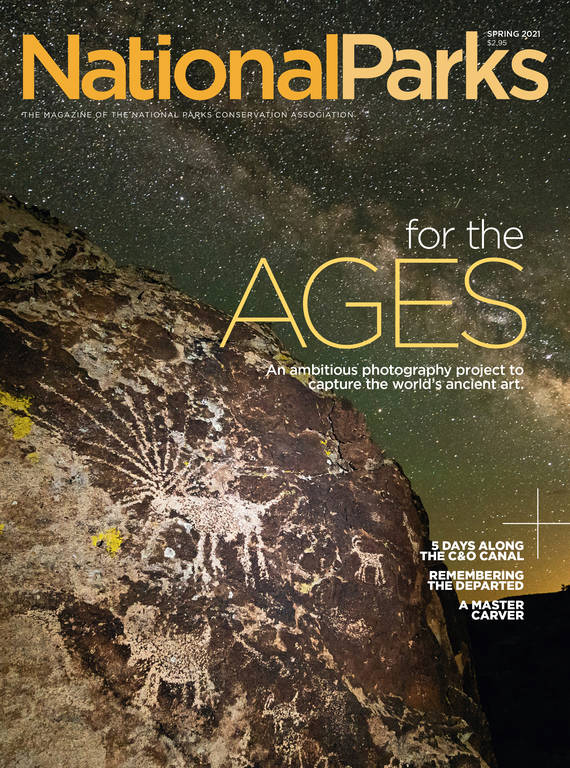
Spring 2021
A Change of Scenery
Getting away from it all on a five-day cycling trip along the C&O Canal.
Three days and 117 miles into my bike ride along the Chesapeake and Ohio Canal, I started seeing things.
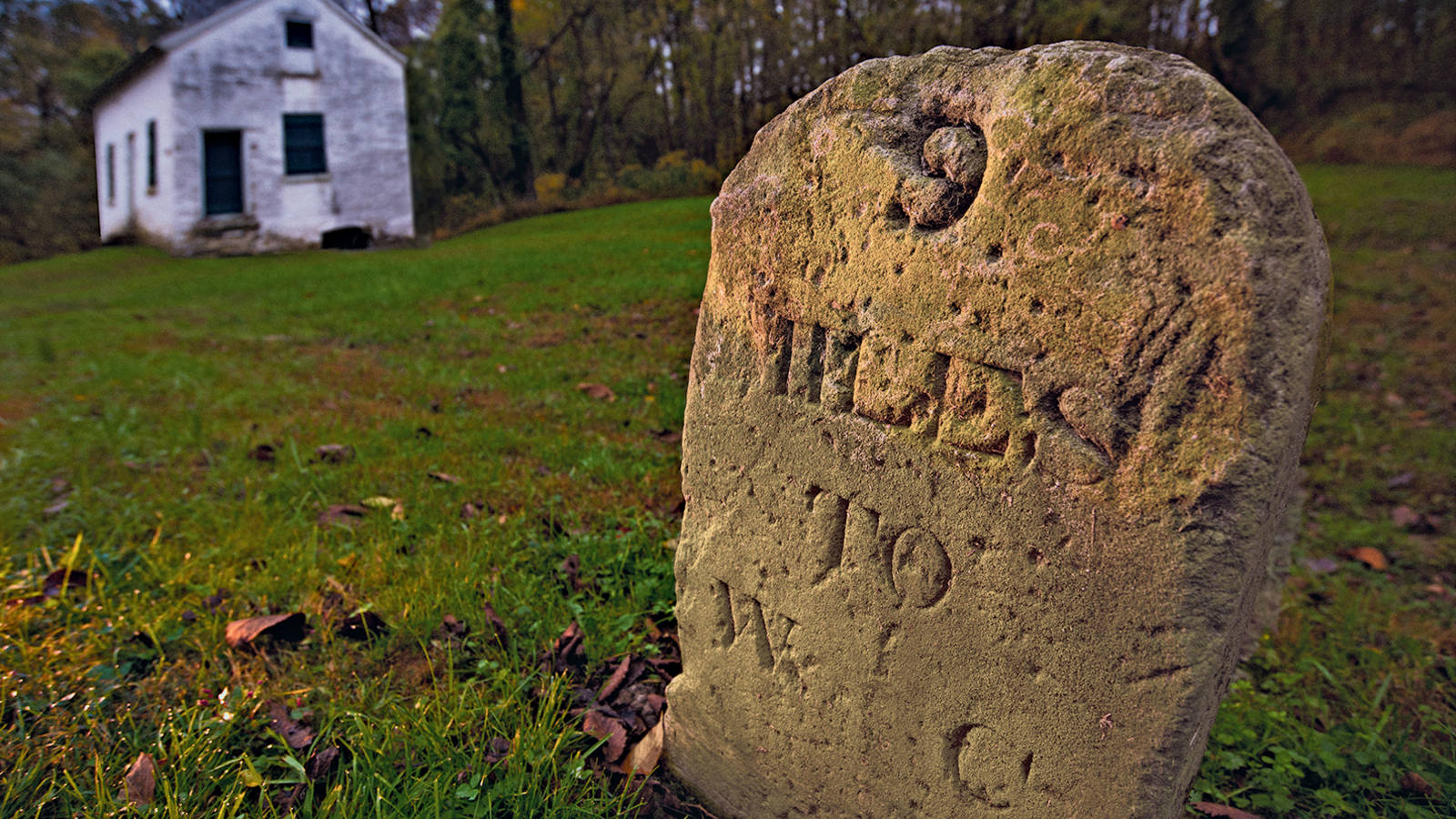
With 4.2 miles to go until the next campsite, I was imagining mileposts where they didn’t exist. It was the latest chapter in an exasperating day: I’d suffered from a headache for most of the morning and then had tripped on wobbly legs, falling hard. Meeting friends for lunch in Shepherdstown, West Virginia, was a welcome reprieve, but the break had disrupted my rhythm on the bike, and I may have been a little overzealous in my fish taco frenzy. Now I was back on the towpath, alone, tired and on the verge of an après-feast collapse. My fingers were sticky from layers of sunscreen, chain grease, chocolate energy gel and hand sanitizer. With every micro-swerve around wayward rocks and roots, the extra weight packed onto my bike threatened to topple me sideways.
© KAREN MINOT
Squinting at a marker in the distance, I was certain I’d conquered another mile since the last numbered post, only to cruise past a cunning tree stump. Time and again, I saw phantom mileposts in fallen trees, shadows and thin air. When the portable toilet at Huckleberry Hill campsite finally came into view, I thought I might weep.
I slowed to a stop on the towpath and surveyed my home for the night: a small, empty clearing in the woods with a lone picnic table. The late afternoon sunlight filtered through the trees, and I saw the water glimmering beyond the half-bare branches. For days, the Potomac River had been my constant companion, yet we’d always kept a polite distance. Now I ached for contact — to dip my toes in and splash cold water on my face. I parked my bike, quickly pitched my tent, kicked off my sneakers and walked down to the river.
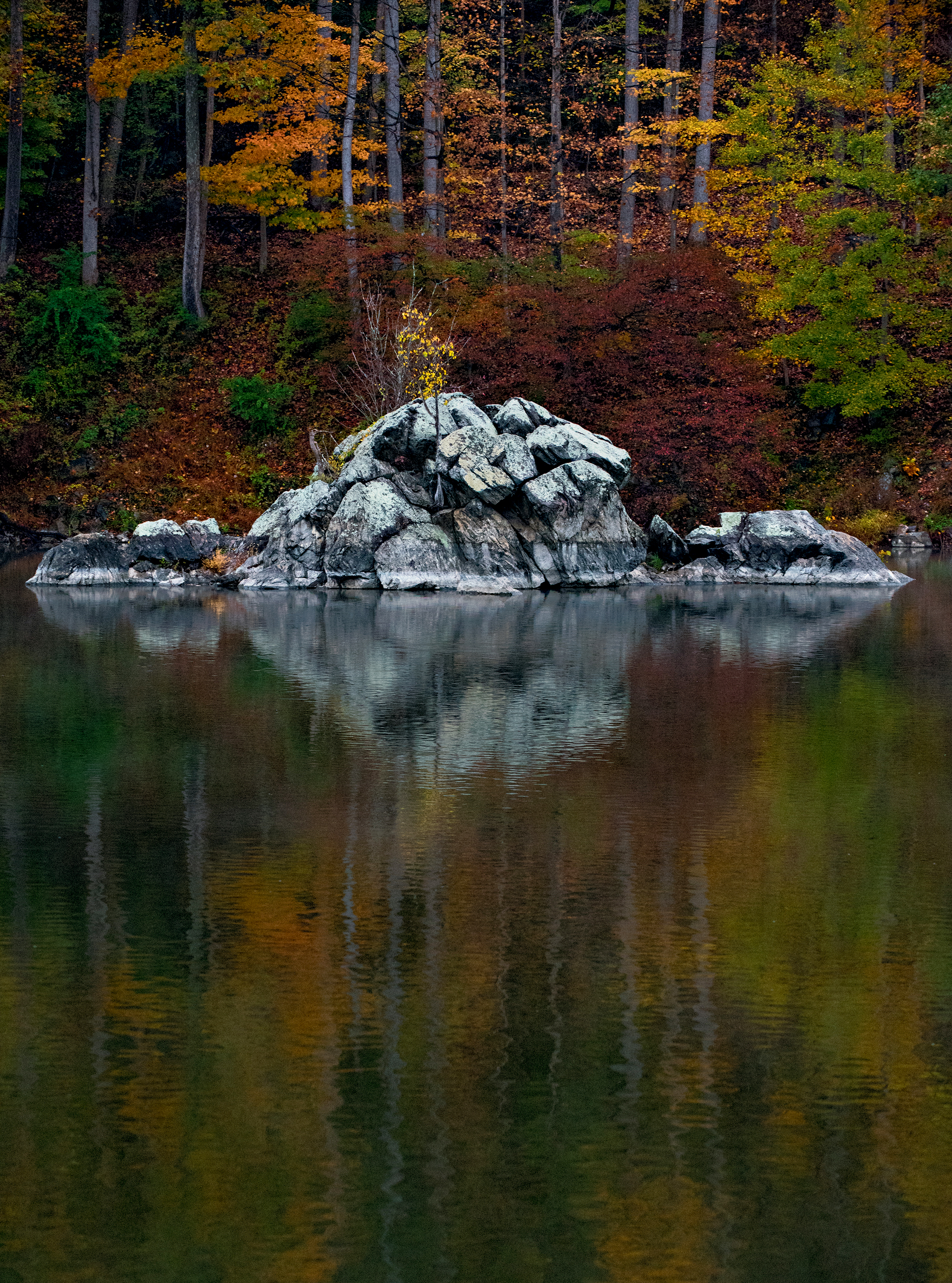
C&O Canal engineers walled off a channel of the Potomac River to create the Widewater basin, where boats would wait their turn before moving upstream through lock 15.
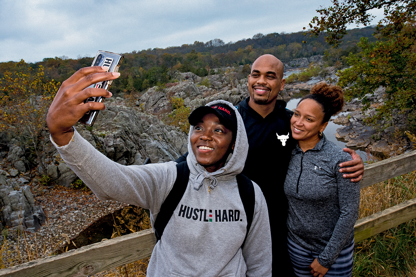
© MICHAEL KIRCHERChesapeake and Ohio Canal National Historical Park stretches 184.5 miles between Cumberland, Maryland, and Washington, D.C., and encompasses nearly 20,000 acres. It is home to 1,200 native plant species, hundreds of animal species, one dynamic river and innumerable spots of breathtaking beauty. Growing up in Maryland, I picnicked with my family in Great Falls Park, which runs along a spectacular section of the river with waterfalls and cascading rapids, and I visited the canal with my classmates to ride a mule-towed boat (the origin of the term “towpath”), a replica of those used during the canal’s working days. I’d explored small sections of the linear park as an adult, and almost a decade ago, one of my first dates with a triathlete was a 52-mile round-trip pedal between White’s Ferry, Maryland, and Harpers Ferry, West Virginia — with zero preparation on my part. I wouldn’t recommend biking the canal this way, but if the excursion had been my date’s way of testing my fortitude, I guess I passed. Plus, it planted the seed for future C&O rides.
Last spring and summer, I had coped with the stress of the pandemic by spending more time on my bike, and when I decided to plan my first multiday ride, the canal beckoned. Eager for a change of scenery, a disruption of my daily routine and the thrill of an outdoor adventure, I planned an end-to-end, five-day trip, which meant a pace of no more than 50 miles a day. I scheduled the journey for two weeks before the presidential election and vowed to stay off all electronic devices.
In the months before my ride, I biked more frequently and played hooky one day for an exhausting 60-mile excursion along the canal and the parallel Western Maryland Rail Trail, which — unlike the towpath — is paved. I also hunkered down with stories about our first president, who rode horseback along the volatile Potomac (known for its floods, rapids and dry spells) at age 16. For much of his life, George Washington dreamed of a trade route that would connect the Ohio River Valley to the Eastern Seaboard. Before becoming chief executive of the country in 1789, Washington was named president of the Potowmack Canal Company. He oversaw the beginnings of a primitive canal system but didn’t live to see its completion.
By 1850, the canal — then run by the Chesapeake and Ohio Canal Company — reached its current length. (It never stretched as far as Pittsburgh or the Chesapeake Bay, as originally intended.) For more than 75 years, mules hauled boats of coal and other raw materials from the Western Maryland mountains to foundries, lime kilns, blacksmiths and mills in Georgetown and beyond. In its heyday, just after the Civil War, the route was so popular that boats sat in traffic, waiting to pass through locks. But a devastating flood in 1889 halted business, and the canal company — losing a fierce competition with the railroad — was never profitable again. Boat operations ceased in 1924.
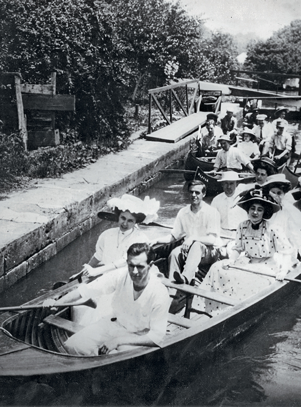
Boaters on the canal in the early 1900s.
COURTESY OF SPECIAL COLLECTIONS RESEARCH CENTER / THE GEORGE WASHINGTON UNIVERSITYOver the next decades, the National Park Service proposed (and Congress approved) turning the canal into a scenic highway, but starting in the 1950s, Supreme Court Justice William O. Douglas, a conservationist, led an effort to reverse course and protect the canal. He called it “a refuge, a place of retreat, a long stretch of quiet and peace.” A section of the canal became a national monument in 1961; the park was expanded to include the entire canal and surrounding lands and was redesignated a national historical park in 1971, the year I was born.
Before I set off on the towpath in October, I read everything I could about packing a bike, which intimidated me far more than the miles. I made overnight reservations at two of the historic lockhouses, organized my freeze-dried meals and borrowed a tiny camp stove. In the final days, I bought spare tubes and practiced getting a tire off and on my bike. After that critical success, I stopped agonizing about getting a flat, which just left all the other concerns: overpacking, overlooking essentials, falling, freezing or starving. The night before my departure, I packed two waterproof panniers and loaded the car. It was time to let nature do its healing.
The next afternoon was an autumn day out of central casting: The air was crisp, and the sun seemed to accentuate every fall color. I walked around Cumberland, stalling, certain I’d forgotten something important. My plan was to bike only a short distance the first day; my friend Robert had agreed to meet me at a campsite just 10 miles away, and my partner, James, who had given me a ride from Washington, would unicycle the first stretch and camp with Robert and me before driving home the next morning. (Yes, unicycle. I’ll stick with two wheels, thank you.) At the trailside bike shop, I asked a mechanic to help me zero my bike odometer. Then, out of excuses, I rode onto the towpath and began my journey. Behind me were the steeples of Cumberland, once a thriving canal town; to my left, the canal and train tracks; to my right, the sparkling Potomac and colorful mountains. Soon we were passing backyards in a residential area and farms with fields like technicolored green carpet. I watched a young deer wade in the canal and stopped to explore a small family cemetery.
NPCA AT WORK
After about an hour, we pulled over at Irons Mountain, one of the Park Service’s 31 free hiker-biker campsites. I set up my tent less than 100 yards from the railroad tracks, and James and I talked to a trio of backpackers who were hiking a small section of the park as practice for a thru-hike. At dusk, Robert rolled off the towpath, towing a large, box-shaped trailer.
I told Robert and James how I’d started off my ride surprised by the speedometer reading. It was higher than I expected, so I was feeling smug about all my training — only to realize later that the mechanic had reset it to kilometers instead of miles. We all laughed.
That night, I pulled out “Captain Kate,” a young adult novel about a 12-year-old girl in Civil War Cumberland who pilots her family’s boat down the canal after her father dies. I’d packed it figuring I wouldn’t be able to absorb anything more complicated after long days of biking. Overnight, the trains sounded like they were barreling through my tent, waking me for long stretches. The next morning, I woke to see steam rising from the Potomac. I was shivering and tired but excited to start moving. James headed back to Cumberland, and Robert and I, wearing all of our warm clothes, headed south.
Along the quiet canal, I initially kept my eyes on the path. Robert, a far more experienced rider, served as our leader, scouting out the towpath just ahead of me. Within the first couple of hours, he had spotted a pileated woodpecker (somehow recalling the brilliant red crest from his fourth grade book report), a beaver, wood ducks and turtles. The weather warmed, and I stopped to shed several layers. When I caught up to Robert, my arms were bare. “Sun’s out, guns out,” he said.
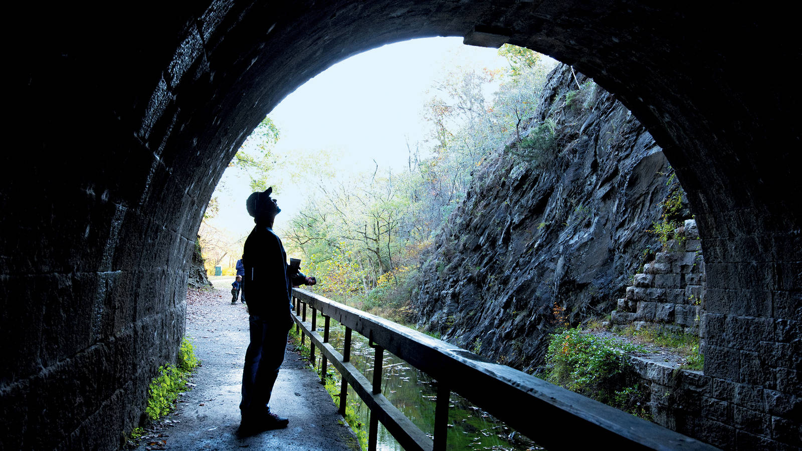
After a quick detour for lunch, we found ourselves at the entrance to the Paw Paw Tunnel, where the canal and towpath go straight through a mountain for nearly two-thirds of a mile. An engineering marvel, the tunnel took 14 years to complete. I’d read it could be dangerous to bike through and was fully prepared to walk if things got dicey. With bike lights to guide me, I coasted cautiously on the narrow and slick path, separated from the canal by only a wooden railing. A couple times my tire slipped, and I panicked, imagining skidding into the dark canal, but I steadied myself and remained upright, biking to the end.
On the other side, the path was covered with pine needles. I stopped to turn off my lights and check a faint clicking coming from my bike rack. With nearly 40 pounds of weight in gear and supplies, I knew there was extra torque on the rack, which could loosen bolts. Everything seemed secure. Then, 3 miles before reaching Fifteenmile Creek, where I’d camp and Robert would pick up his car to head home, I heard a thud. My bike ground to a crawl, and I turned around to see my bags and tent dragging on the path. The bike rack had pivoted off its axle, and the bolts that held it together were gone. Eagle-eyed Robert backtracked, found one and suggested we pile my bags in his trailer. “We’ll figure out a plan at the campsite,” he said.
At Fifteenmile Creek, we befriended two campers with a pickup truck full of tools that they were happy to lend to the cause. They secured my remaining bolt and added a zip tie. With my bungee cord, I was back in business. That night in the tent, I continued reading about Kate’s adventure. We were moving in the same direction on the towpath, through the same towns, and we both ate oatmeal for breakfast and beans for dinner. But while I overcame a broken bike rack, she avoided Confederate soldiers and cut her hair to disguise herself as a boy, part of an elaborate scheme to skip school and get her family’s coal-filled boat to Georgetown.
I was still thinking about the book the next morning when I set out on the trail. Like Kate, I loved when the towpath was a narrow causeway between the Potomac and canal. In other sections, the path veered away from the river and hugged a field or forest. The towpath itself can vary widely: A lot of the surface is crushed limestone, but sometimes it’s grassy, gravelly or muddy. The route is generally flat, although headed toward Georgetown there’s a slight decline at each of the 74 locks that were used to raise and lower boats. I was thankful I wasn’t riding in the opposite direction.
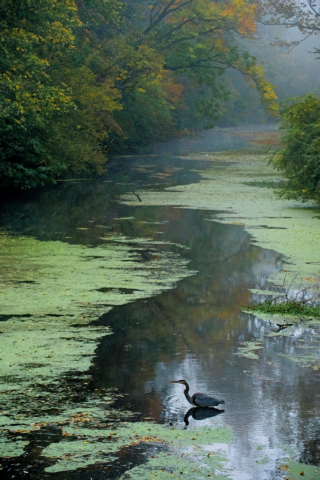
A great blue heron at Swains Lock in Travilah, Maryland.
© MICHAEL KIRCHERMidafternoon, after passing the town of Hancock, Maryland, I arrived at Lockhouse 49, where I’d be spending the night. One of 27 remaining lockhouses (seven of which are rentable), it’s a sparsely decorated brick house with slightly sloping wood floors, braided rugs and no running water. After hanging my dewy tent on the porch to dry, I tightened the bolts on my bike and rack and organized my gear, waving to the occasional cyclist on the towpath. I fell asleep by 8 that evening, though at 1:30, my eyes blinked open. I rolled over to look out the window next to my bed and saw Orion in the sky, above the towpath, blinking back at me.
The morning was spectacular as I headed out for what I expected to be my longest day. I looked across the glassy river to West Virginia and could see the trees perfectly reflected in the water, a fall bouquet of yellow, orange and green. As I pedaled, colorful leaves floated down in front of me, landing softly on a yellow trail. On the curvy towpath, the rising sun was sometimes directly in front of me, other times behind me or to my right, casting parallelograms of light onto my route. At one point, I felt like I was pedaling through a Disney montage: Squirrels leapt, a white-tailed deer bounded across the path, a great blue heron took off from a log in the canal, and fish jumped in the river. When a blue bird flitted across the path, I had to chuckle out loud.
I went hours without passing any humans and drank up the solitude. Even though I had scarcely seen friends or family during the seemingly endless quarantine, I’d been cocooned with James almost nonstop. Now, for the first time in the better part of a year, I’d been alone long enough to find comfort in my own company.
TRAVEL ESSENTIALS
As much as I was savoring the time by myself, I also enjoyed chatting with other cyclists and thru-hikers. I met some cyclists who were biking the canal in three days, rushing to catch a train in Washington or hurrying the other way to Cumberland. But even the fast-trackers, arriving at campsites after dark, were approachable, kind and glad to exchange tips about trail conditions and water and food access. Over the past couple days, I had met two men from Boston hiking the towpath in my direction and a retired couple from Northern Virginia who had biked the canal annually for 30 years; this year their cargo included slippers, camp chairs and a Pomeranian.
In Williamsport, Maryland, once an important coal transfer point, the towpath crossed over Conococheague Creek on one of the canal’s most impressive stone aqueducts, which had been restored recently. I saw a fishing boat and greeted a few runners and dog walkers. One man, seeing my bags and tent, yelled out words of encouragement: “99 to go!”
By 9:30, it was 70 degrees, and I was already hungry. I stopped every few miles to fuel up with trail mix or a peanut butter tortilla wrap and to listen to water rushing around rocks in the river. Since I had planned moderate distances most days, I had expected to take detours and bike through towns like Williamsport and Sharpsburg, home to Antietam National Battlefield. But at every canal town, I found myself focused on reaching my next meal or campsite and reluctant to add mileage.
Before long, my hunger turned into a headache. I thought I was eating plenty, but I was burning enough calories to operate at a deficit; the miles and extra weight had caught up to me. The fish tacos in Shepherdstown solved the hunger problem but afterward, I felt foggy. Everything was moving in slow motion, and I didn’t think I could make it to Harpers Ferry, the historic town just west of the point where West Virginia, Virginia and Maryland meet. I absentmindedly pondered how long I could go without pedaling. I tried to pass time by calculating distances in my head, but the milepost numbers going down and my odometer numbers going up was enough to confound me. As I approached a backpacker, I slowed and asked where the next campsite was. “4.2 miles,” he said, adding that he would be stopping there for the night. A wave of relief rushed over me — not only was the distance manageable, but our short exchange had alleviated my fears about camping alone. “I might see you there,” I said.
Before I’d left home, James’ hardcore unicyclist friend Leo, who had recently completed the entire towpath on his one wheel, shared some tips and told me how much he relished plunging into the water after long days of riding. Once I’d finally made it to Huckleberry Hill and was alone in the setting sun, I headed to the river for my own long-awaited dip. But when I stepped in, thick mud swallowed my feet; with each step, I sank deeper. Deflated, I moaned out loud before extracting my broken flip-flops. A moment later, I laughed. Nothing could dampen my joy: I had biked 46 miles and now looked forward to a glorious night of camping on the bank of the Potomac. Barefoot and muddy, I walked back to my tent.
My new backpacker friend walked into camp just before dark. Preston was a pro: A retired civil servant, he had hiked 1,200 miles of the Appalachian Trail in sections and was averaging 20 miles a day on his end-to-end C&O hike. We bonded over our journeys and the pleasure of being digitally unconnected. It was warm enough to keep my rain flap open once I had crawled into my tent, and I could see the crescent moon reflected in the Potomac. An owl cooed, and the reassuring train whistle, which I’d heard every night, echoed across the water. For what seemed like an eternity, the taps of leaves landing on my tent and plunks in the water kept me awake, but eventually, I gave in to sleep.

National Parks
You can read this and other stories about history, nature, culture, art, conservation, travel, science and more in National Parks magazine. Your tax-deductible membership donation of $25 or more entitles…
See more ›In the morning, Preston got ready as I was making oatmeal and hit the trail before sunrise; we agreed to look for each other at Harpers Ferry. I took my time packing and loading gear, then set off in daylight. As I approached town, the Potomac changed dramatically, with large boulders dotting the water. I recognized Preston’s backpack at the base of the pedestrian bridge and left my bike nearby. Clouds hung low, and winds swirled as I left the towpath and crossed the river into West Virginia to reach The Point, the confluence of the Potomac and Shenandoah rivers. A couple of birding and hiking groups passed me (on the Maryland side of the water, the Appalachian Trail runs along the towpath for 3 miles). Church bells rang, and a freight train disappeared into the mountain, a sight that reminded me of my father’s model train set and that, at full scale, never fails to amaze me. I waited a few minutes for Preston, then left a note on his pack and pressed on.
Back on the saddle and thankful for the shady tree canopy, I soon started passing places that felt like home. I rode by Horsepen Branch campsite, close to some fields where I’d seen sunflowers explode in the summer, and Riley’s Lock, where I’d kayaked for years. It was my second-to-last day, and I felt euphoric: I’d settled into a good rhythm, and I saw a shower in my near future. For once, mileposts came faster than I expected, and then, remarkably, I was at mile 27. Realizing that my solo time was now scarce, I tried to slow down, but the dogged mileposts kept coming. Hundreds of geese flew overhead, moving south at probably twice my speed. And from a half-mile away, I saw Lockhouse 21, a small, welcoming white house glowing in the warm sun. Another 46-mile day was over.
The 1916 house (originally built in the 1830s) is called Swains Lock after the family that lived there for more than a century. After a long shower, I sat on the grass in front of the house with friends who showed up to help me celebrate my final night. James brought pizza for everyone, our friend Sally made brownies, and Leo asked for mile-by-mile accounts from my ride. Later that night, I finished “Captain Kate” and slept soundly, waking once and desperately missing the sounds of the wilderness.
ABOUT THE PHOTOGRAPHER
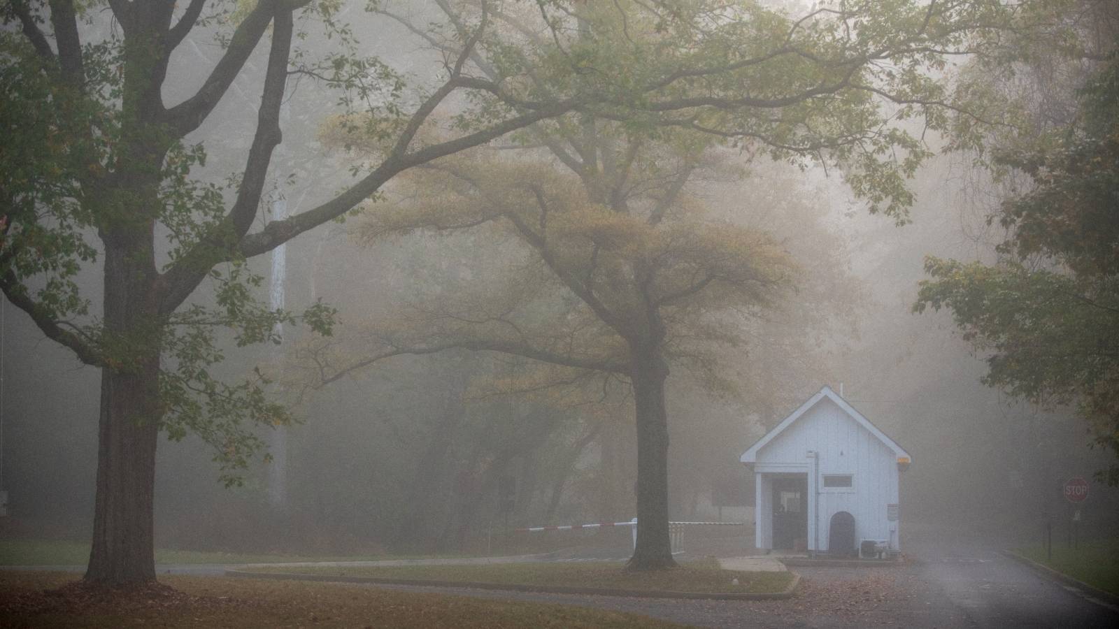
I set out the next morning in a thick fog. Crossing over the canal on a small bridge, I looked both ways on the towpath and weighed my options. To the south, I could imagine each of the remaining 16 miles: I would bike right into morning rush hour — runners in face masks, walkers on their phones, cyclists carrying tennis rackets and fishing rods. I’d pass names familiar to me from childhood: Great Falls, Glen Echo, Fletchers Cove. I’d ride into Georgetown, over Rock Creek and at last, to the final milepost, across from the famous Watergate complex. Another 5 miles, and I’d be back on Capitol Hill with James, luxuriating in the comforts of home and sweet cuddles from my beagle, Hamilton. If I backtracked and went north, I could delay my reentry into a stressful world. I would once again enjoy long stretches of quiet, and I’d probably bump into Preston, who, I would later learn, would go on to have his own personal best hiking day — 32 miles. I imagined stretching out my food supply and squeezing in just one more night of camping — seeing stars, hearing animals, feeling scared and invigorated and alive.
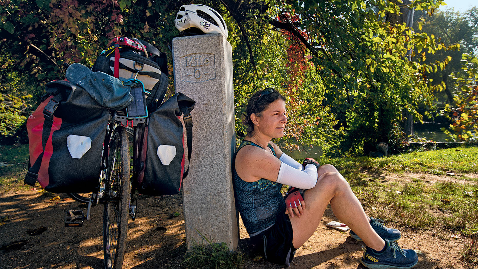
I listened to the rush of the water at the lock for another minute and resolved to stick with my plan. Then I waited for a break in the flow of exercisers on the path, stood up on my pedals and steered south, heading, unhurriedly, to Mile 0.
About the author
-
 Melanie D.G. Kaplan Author
Melanie D.G. Kaplan is a Washington, D.C.-based writer. Her first book, "Lab Dog: A Beagle and His Human Investigate the Surprising World of Animal Research," was published in 2025. Learn more at melaniedgkaplan.com.
-
Press Release
Cadiz Pipeline Permit Threatens Mojave Desert Groundwater
“The facts are clear. This groundwater mining proposal would drain the desert and rob the Mojave of its rare springs and wildlife habitat."—NPCA's Chance Wilcox, California Desert Associate Director
-
Press Release
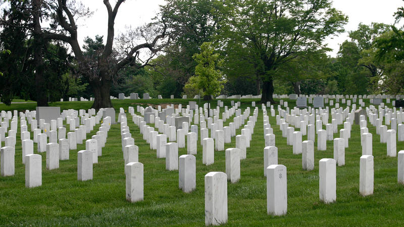
Veterans, National Park Advocates Join in Opposition to Triumphal Arch
“We find unity in our national parks. T
