NPCA’s traveling parkie beats the heat at an ancient watering hole and reads messages from the past at El Morro, the country’s second national monument
This story is part of a series by Jim Stratton exploring some of America’s most fascinating and least known places.
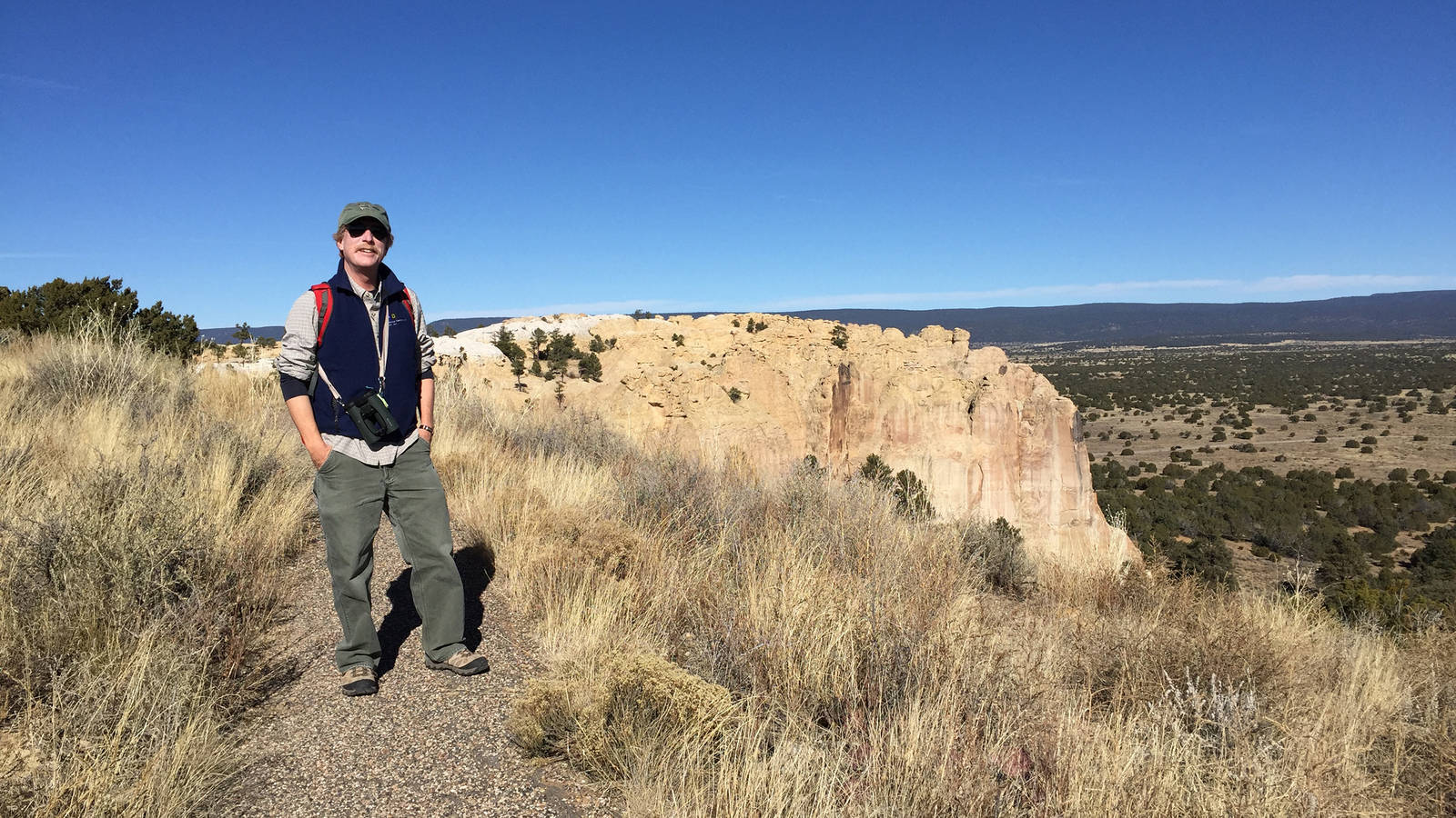
I’m from Alaska, and people like me who can’t do heat just don’t travel to the southern regions of the country during the summer. So when nonprofit board responsibilities took me to New Mexico last December, I eagerly extended my stay to visit national park sites near Santa Fe.
This is how I discovered El Morro National Monument and its centuries-old stories carved in a huge sandstone bluff. Traveling two hours by car from Albuquerque, my girlfriend Craig and I were completely blown away by yet another monument we had never heard of, one that told an amazingly rich story about the history of the American Southwest. What we thought would be a quick visit evolved into most of the day as we explored every nook and cranny of this 110-year-old park site.
Our first big surprise when we arrived at the visitor center was learning that President Teddy Roosevelt protected this area on December 8, 1906 with his second-ever use of the Antiquities Act. Who knew? The Antiquities Act was passed by Congress earlier that same year to provide the president with authority to create national monuments from public lands to protect significant natural, cultural or scientific features. It has been used by almost every president since 1906. But only Devils Tower in Wyoming predated this national monument as a place so significant a president would take action to protect it as a national park site. (The Grand Canyon, for the record, wasn’t established by Roosevelt until two years later in 1908.)
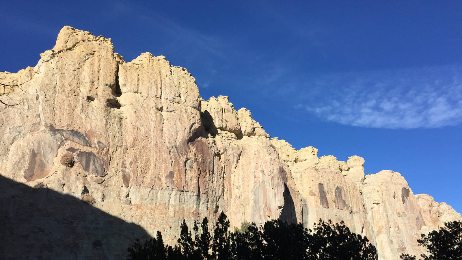
El Morro means “the headland” or “the bluff” in Spanish. Rising from the surrounding valley floor, El Morro’s prominent feature is a “cuesta” — a gentle, upwardly sloping rock headland that ends abruptly in a 200-foot nearly vertical face. At the base of El Morro is a 12-foot-deep pool of snowmelt and rain runoff that collects in the protected shade of the cliff. This year-round water source was a major stopping point along a trail system first established by the Ancestral Puebloans and later used by Zunis, Spanish explorers and Anglo settlers. While camping here, these travelers collectively carved 2,000 signatures, dates, messages and petroglyphs into the soft sandstone of what is now called Inscription Rock. The first inscriptions were petroglyphs of bighorn sheep and bear paws carved by ancient Zuni Indians whose ancestors disappeared from the region almost 1,000 years ago (similar to artifacts at Chaco Culture National Historical Park, about 130 miles north of El Morro). You can explore the remnants of an ancient village on top of the sandstone mesa at El Morro. It is widely speculated that a drought may have caused the Ancestral Puebloan people to vacate this part of the Southwest a millennium ago, but people kept traveling the trails, and El Morro’s year-round water source ensured that this oasis was a regular stopping point.
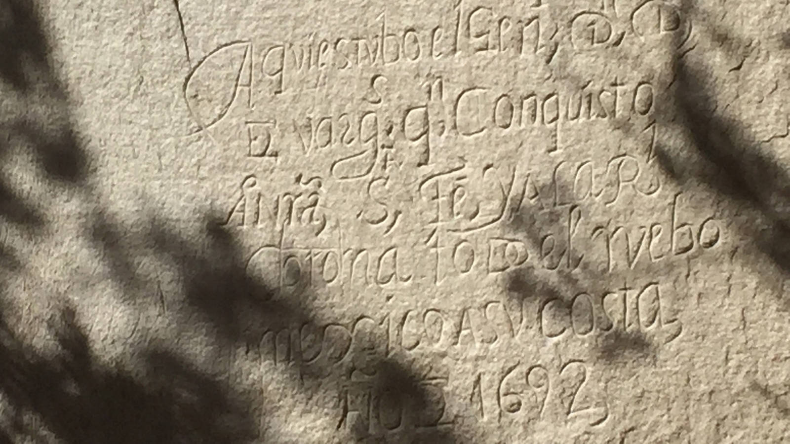
The first non-indigenous travelers to the region were the Spanish who explored the Southwest seeking mythical cities of gold. Spanish inscriptions date to “16 April 1605” (two years before colonists formed the first permanent English settlement in the country in Jamestown, Virginia), when the first Governor of Mexico carved his name, Don Juan de Onate, into the sandstone. Governor Manuel de Silva Nieto added his name on “5 August 1629” and Captain Juan de Arechuleta “passed by here, in the year 1636.” General Don Diego de Vargas added his name in 1692 and General Juan Paez Hurtado came through in 1736. The last of the Spanish names inscribed in sandstone was Andres Romero in 1774. The calligraphy carved in stone by these Spanish explorers is a marvel. Even after hundreds of years, you can still read the dates, names and messages, including some poetry, beautifully etched in the sandstone. A guide provided by the visitor center annotates the most prominent and historically interesting of the inscriptions.
Some of the earliest Anglo inscriptions were from U.S. Army “camel jockeys.” In the 1850s, the Army experimented with camels to support its desert operations, and several camel-supported expeditions came through this area during that time. One of the latest inscriptions is from R.H. Orton, a cavalry soldier returning to California after the Civil War — he carved his name in 1866. By the early 1900s visitors adding their names were starting to deface the historical quality of El Morro. That’s when President Roosevelt acted to protect this unique piece of history.
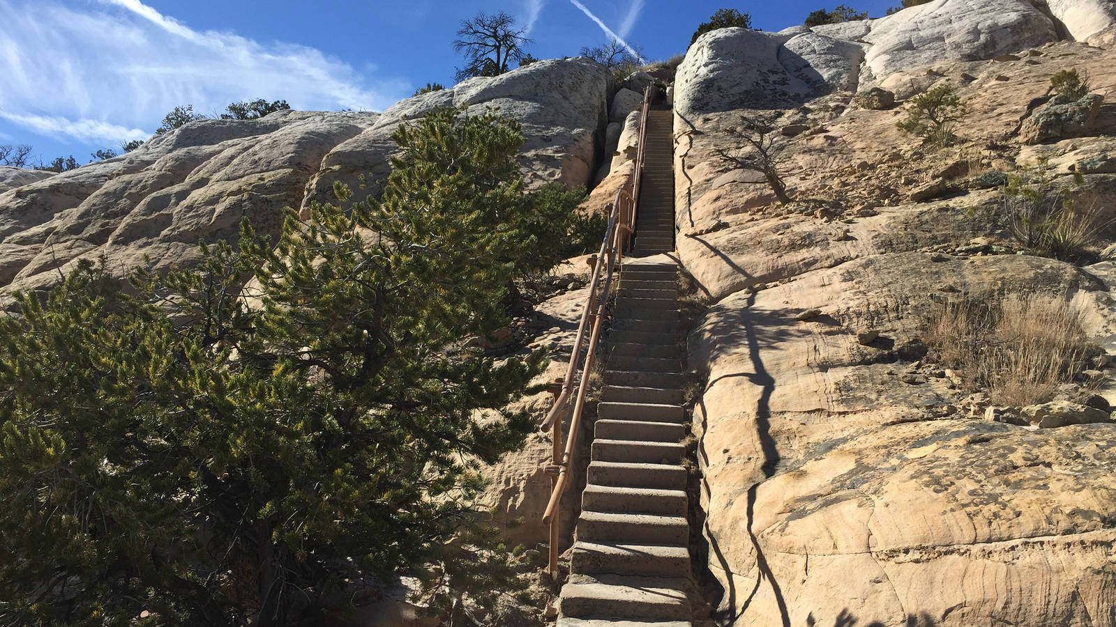
El Morro has been protected as part of the park system for over 100 years, and its visitor infrastructure, including a campground, is well developed and welcoming. A trail built in 1933 by the Civil Works Administration takes you from the visitor center, up a hundred steps carved into the east side of the mesa, through the Ancestral Puebloan village site and along a trail carved into the rock at the top of the mesa, down a switchback trail on the mesa’s west side to the base of Inscription Rock where, among the Gambel oak and pinyon pine, an interpretive trail guides you through the centuries of signatures in sandstone. The trail to the top is an easy two-mile loop and the half-mile Inscription Rock loop is easily accessed directly from the visitor center if climbing steps to the top isn’t your thing.
Stay On Top of News
Our email newsletter shares the latest on parks.
Now that winter is approaching again, it’s a great time to plan a trip. Any way you experience this amazing collection of messages, dates and signatures, be sure to give yourself enough time to read them all!
See more in this blog series by traveling park lover Jim Stratton exploring some of America’s most fascinating and least known places.
